Part Twenty-Three: Death Valley Waterfalls
(First time reading this 'Desert Daze' story? Scroll down to 'Older Posts' to start with Part One)
A river runs through it. No really – as I drive across the park, each time I reach a low point in the road, a stream is running across it causing me to have to slow down, as the water is up to a foot deep in places. Bizarre, considering where I am.
Almost all the other roads in the park are still closed - washed out, sand covered or, in the case of higher elevations, snowy and icy. These conditions deny me access to most of the park and make me a little claustrophobic. After a week and a half of solitude and open spaces, of seeing few vehicles and even fewer people, this feels like a small city – hustle and bustle, traffic and people milling about - all trapped in this one section of the park.
As mentioned in an earlier post, I no longer visit most National Parks because they have become so crowded they no longer feel wild at all. (I call the valley portion of Yosemite “Yosemi-City”; there is no longer a ‘slow season’ there to visit, just always lots of vehicles spewing exhaust with long lines of traffic commonplace.) DV has never suffered this problem because it’s vast and, with the exception of today, visitors are usually spread out over the entire park.
Therefore, I need to escape. My plan: I’ll hike to a couple of remote waterfalls. Waterfalls you say? In DV? No, not the extremely temporary kind created by all the rain whose lives can be measured in hours, but one that is year-round and another that, fed by snowmelt from the surrounding mountains, runs for about six months of the year. Both hikes are upstream and long enough to discourage those who aren’t willing (or able) to make the effort – and that’s most people – so I’m assuming I’ll encounter few others. I’m right; in fact, I do not see another soul in either location. I have my tranquility back.
I decide to hike to Darwin Falls first. This waterfall is truly an anomaly in the middle of the desert. It's fed by the China Garden Spring high up in the hills which consistently produces enough water to supply the creek and falls all year (along with the nearby tiny settlement of Panamint Springs.) I make my way upstream towards the falls through luxuriant growth that effectively shields the creek bed from the parched desert all around it. If I had somehow been plopped down here with no clue as to where I was and without seeing the surrounding desert, even my wildest guesses probably wouldn’t include DV.
Almost all the other roads in the park are still closed - washed out, sand covered or, in the case of higher elevations, snowy and icy. These conditions deny me access to most of the park and make me a little claustrophobic. After a week and a half of solitude and open spaces, of seeing few vehicles and even fewer people, this feels like a small city – hustle and bustle, traffic and people milling about - all trapped in this one section of the park.
As mentioned in an earlier post, I no longer visit most National Parks because they have become so crowded they no longer feel wild at all. (I call the valley portion of Yosemite “Yosemi-City”; there is no longer a ‘slow season’ there to visit, just always lots of vehicles spewing exhaust with long lines of traffic commonplace.) DV has never suffered this problem because it’s vast and, with the exception of today, visitors are usually spread out over the entire park.
Therefore, I need to escape. My plan: I’ll hike to a couple of remote waterfalls. Waterfalls you say? In DV? No, not the extremely temporary kind created by all the rain whose lives can be measured in hours, but one that is year-round and another that, fed by snowmelt from the surrounding mountains, runs for about six months of the year. Both hikes are upstream and long enough to discourage those who aren’t willing (or able) to make the effort – and that’s most people – so I’m assuming I’ll encounter few others. I’m right; in fact, I do not see another soul in either location. I have my tranquility back.
I decide to hike to Darwin Falls first. This waterfall is truly an anomaly in the middle of the desert. It's fed by the China Garden Spring high up in the hills which consistently produces enough water to supply the creek and falls all year (along with the nearby tiny settlement of Panamint Springs.) I make my way upstream towards the falls through luxuriant growth that effectively shields the creek bed from the parched desert all around it. If I had somehow been plopped down here with no clue as to where I was and without seeing the surrounding desert, even my wildest guesses probably wouldn’t include DV.
I spy a pipe running alongside the creek – it’s no larger than a few inches in diameter. The entire water supply of Panamint Springs runs through this conduit. I reach the falls. A single ‘fall’ charmingly splits into two as it makes its way down the rock face. Small by almost any standard, these falls may as well be Niagara Falls to me today - I think they are just spectacular. Surrounded by lush growth - trees, shrubs, and even several hanging fern gardens
 and with birds high up in the trees singing praises of the place, I feel like I have found the mythical Garden of Eden. I sit down in the shade to eat my lunch serenaded by the always alluring melodies of falling water and beautiful birdsong – in the middle of the desert - magical!
Next: Willow Creek Canyon Falls and the Bighorn Sheep


 and ‘The Bottle House’ (sorry, I didn't get a good shot):
 A house built from thousands of beer and liquor bottles by Tom Kelly in 1906. Most of the other buildings, including the bank, schools, and jail, have long since decayed and partially or completely caved in.
 It’s snowing and sleeting at this elevation (3,800 ft.) as I poke around the ruins, a raw day.
 And it’s early so I have the place completely to myself. All the better to feel the spirit of the place - it’s kind of creepy actually. No one would choose to live here without gold for incentive, it’s bleak, dry, extremely hot in the summer and remote. How quickly they fall when the gold (money) runs out.
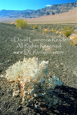 But Death valley has its own kind of unique beauty – the earth laid bare revealing bands of pastel colors running through the rock walls of the surrounding mountains – in places it resembles different flavors of ice cream layered on top of each other if one uses a little imagination.
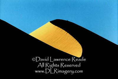
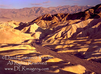 At sunset and sunrise, when the low sun accents the colors, the effect can be quite stunning. Sand dunes also stand out during the magic hours of dawn and dusk, taking on a warm glow with long shadows accenting their textures.
 So why do I find myself in a motel again tonight, outside of the park? Because, believe it or not, it is pouring relentlessly and all the roads in the park are closed due to flooding (and snow and ice at higher elevations.) What? In Death Valley? The place where the 1.9 inch annual rainfall is greatly exceeded by an evaporation potential of 150 inches per year? Yes, I have timed my arrival perfectly (not.)
 It’s chilly here at 7,500 feet and scattered snow patches contrast nicely with the vivid reds. I start hiking to the top of a ridge to gain sweeping views into the canyon; it’s slow going in the shifting red sands at this elevation. When I finally reach the top, I am breathing heavily. I stop, catch my breath and marvel at the splendor spread out before me.
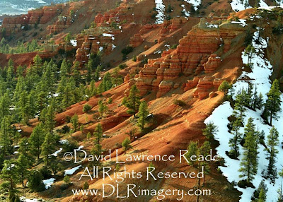 The sand resulting from the erosion of the rock settles smooth creating an unreal-looking soft landscape of rich color and sexy silkiness (if rocks and sand can ever be sexy and silky, they are here, or maybe I’ve just been out here alone for too long.

 This is excellent exercise, not just for the heart and muscles, but for coordination and mental alertness as well. It occurs to me that hiking like this is a great activity for overall fitness, one that just about anyone can do at their own pace. And this is not to mention being given the privilege of beholding some of Mother Nature’s finest while doing it - lush foliage, gorgeous wildflowers, magical encounters with our forest friends, heartbreakingly beautiful birdsongs and the incomparable sweet and oxygenated fragrance of the forest to mention a few.
 If it’s been a while since I last visited one of these sylvan cathedrals, I start to feel disconnected from the world around me. But as soon as I enter the woods, I’m renewed, at once both in touch with the cosmos again but freed of its challenges and problems, at least for now. Surrounded by forest, I am somehow incapable of worry.
 Sadly, every last scrap of woods that I grew up exploring in as a child is long gone. With suburban sprawl pushing out further and further, forestland is disappearing at an alarming rate - so I hike that which remains whenever I get the chance. Developers don’t seem to have learned what I have in this life: money in itself cannot bring happiness – I’ve been both well-off and poor – but a simple jaunt in the woods can. I’ve never not felt better, physically, mentally and spiritually, after a hike than before. I hike for my health!


 and almost miss the road heading off west to Boulder.
 Up here, the weather is different; there are patches of snow scattered about and the wind is bitingly cold. I am on the Burr Trail, named after John Atlantic Burr, who was born in 1846 aboard the SS Brooklyn somewhere in the Atlantic Ocean. He and his family lived in Salt Lake City, then later moved south and established the town of
 Turns out this wall of rock I am driving next to is the ‘
 By now, you’d think I’d have had enough of hoodoos but I can’t resist. The hike is tough going; it’s through disturbed desert (cattle grazing – I’ll say it again, what in the heck are cattle doing grazing in the desert?), a painfully slow slog through loose sand. I realize that my legs are still very tired from all the ambitious hiking I’

 It’s warmer here than any of the other places I have camped so far and not just because of the fire; I’m at lower elevation, 2,500 feet lower than last night for instance, which makes for about a ten degree difference. With the fire, that’s really significant, and, for the first time on this trip, I’m actually comfortable being outside after the sun goes down without needing to bundle up like the Michelin man. Real bathrooms, running water, good wine, a nice fire and relative warmth - I guess you could say I am on ‘vacation’ tonight!
 It’s cool, but not frigid and I am actually enjoying the morning placidity without shivering for once. There’s hardly a sound except for my breathing and the occasional vehicle passing by out on the highway. I consider staying here for another day – it’s all so very comfortable - but decide against it; there’s so much yet to explore and only a little more than a week of ‘vacation’ left to do it!
 I glance down uncomfortably at the gas gauge edging down inexorably towards ‘E’, my last fill was way back in Page, Arizona (in hindsight, I
  Sucking on fumes, I come to the intersection with Route 276, which angles off to southwest towards Lake Powell. It dead ends at the lake (in the summer there is ferry service to the other side where the road continues) but my map shows another tiny town called
 Neat. Again, I reflect on how simple life is during an adventure like this. My biggest concerns are typically: What should I shoot (photograph)? Where should I head next? Do I have enough food for the next few days? Water? Wine? Gas? I must figure out how to sneak away on adventures like this more often…

 I take the dirt road that leads up to and then beyond ‘Hat Rock’; it ends at the banks of the San Juan. This would be a beautiful place to camp but I decide that I want to be at Muley Point for sunset so I turn around and drive back to the main highway. From here, I can see Cedar Mesa looming in the distance like a giant wall; Muley Point is at the top of that wall. To get up there you must take a steep gravel road that ascends 1,100 feet in three miles over a series of switchbacks. Well before the beginning of that ascent, there are signs posted dissuading large vehicles from continuing on; some of the switchbacks involve extremely tight turns.
 So it’s ironic when, as I begin the ascent, I see a huge tanker truck coming down towards me, brakes squealing and engine roaring - the driver has obviously ignored all the warning signs. I pull over to let him by; he waves thanks. At one particularly tight bend, he performs a three point turn to make it; he seems to know what to expect, he must have driven this route before.
 After marveling over this view for a few minutes, I climb back into the truck and continue on until I reach the turnoff for Muley Point Road. It’s a rough gravelly road and, like before when I traveled the deeply rutted road to Coyote Buttes, I must focus my full attention on my driving to avoid bottoming out. It’s a jostley five mile ride, but all that is immediately forgotten when the view of the goosenecks of San Juan River canyon suddenly appears at the end.


 My legs, complaining the whole way, manage to drag my tired torso back to the entrance and the scene of the couple of unnecessarily added hiking miles early this morning. Those extra miles are looming large now as I trudge up the wash, staring at my feet, willing them to keep moving. After what seems like forever, but in reality is only about a half mile, I look up and, hooray! - there it is - Hotel Truck. Its four wheels and shining shell of steel never looked so good! Oh magic ride, take this crumbling carcass some where it can sleep, in a heap, long and deep – won’t need to count sheep to fall asleep!
 The Wave consists of Jurassic Navajo Sandstone and is named for its resemblance to a cresting ocean wave. Its coloration is a wide range of red, orange, yellow, white, and purple hues largely controlled by iron oxide mineralogies that document diagenetic (the conversion of sediment into rock) fluid flow and chemical reaction fronts.
 Finally, another one of the fortunate twenty shows up; that’s my cue to go off and explore other intriguing parts of CB that I passed up previously in favor of spending alone time with the one and only ‘The Wave’.
 Posts
Posts